2012 Outback Trek Blog Sections

During the 3 month period from June to September 2102 we did a long trip across several deserts and outback tracks across WA, NT and SA.


Our blog for this trip has been published in several sections:


Home to Great Central Road via Yulara

Great Central Road to 80 Mile Beach across the WA desert tracks, accompanied by Dave and Pauline
Port Hedland to Carnarvon down the Ningaloo coast
Carnarvon to Marble Bar across the inland of WA
Marble Bar to Derby via Broome
Derby across the Gibb River Road and Wyndham to Timber Creek
Timber Creek to Tennant Creek via Kununurra and Katherine
Tennant Creek to Alice Springs
Alice Springs to Home via the Old Andado and Oodnadatta Tracks

Our trip took us 14,000 km in 3 months across 3 states, 5 deserts and 10 outback tracks.


The tracks we covered were:


Great Central Road (from Yulara to Tjukyirla)

David Carnegie Road
Eagle Highway
Talawana Track
Canning Stock Route (centre section from Well 24 to Well 33)
Kidson Track
Gibb River Road
Parry Creek Road (Wyndham to Kununurra)
Old Andado Track
Oodnadatta Track

The deserts we crossed were:


Great Victoria Desert

Gibson Desert
Little and Great Sandy Deserts
Pedirka Desert
plus part of the Simpson Desert

Considering the pounding and difficulties on some of the tracks we’ve done, I continue to be impressed with the capabilities of our Oka. It’s a 6 tonne monster but it’s also our home and lifeline while in remote locations. It’s not fast or nimble but there are not many places it hasn’t successfully taken us to (and brought us back from).


We had no punctures (although 2 tyres have made their last trips), no major breakdowns (only a broken shock absorber mount) and only a few of the normal electrical problems. All the mechanical mods, upgrades and preparations worked fine.


So another very good trip, the best part being the Eagle Highway section (which has substantially disappeared from view now) while in the company of Dave and Pauline and several casks of wine.

Home to Great Central Road

5th June
Left home 12.30, lunched at Pt Wakefield and reached Mambray Creek rest area for the night after 250km today.
Called D and P for quick chat.
Compiled a TWF (Things We Forgot) list.
6th June
Went shopping in Pt Augusta for all the things on our TWF list and got most of them, and fuel.
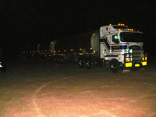
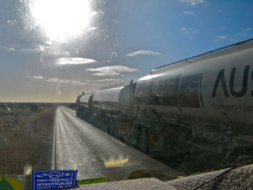
While doing 90kph on the Stuart Highway north of Pt Aug we were overtaken by huge road train, and 75000 litres of volatile fuel moving at 110 kph is something you don’t want to get in the way of.

96d8bb35-2012-09-9-00-00.jpg

A stone thrown up from another road train made a large chip in the windscreen beneath Vinko’s a/c label. It will probably spread to become a $400 insurance claim.
Camped at the Bon Bon Campsite after a tiring 400km drive.
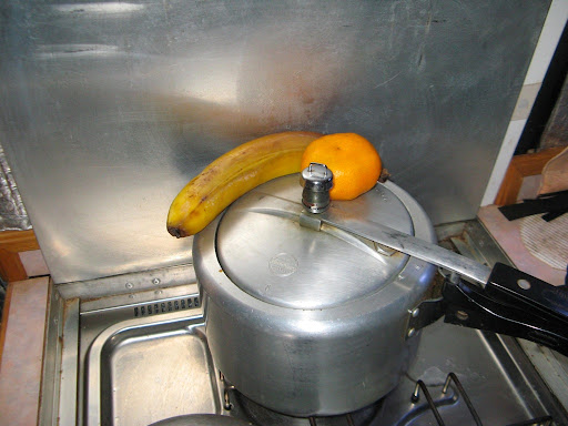
Defrosted fruit from an over zealous fridge on the lid of the pressure cooker filled with stew. J thinks there’s a mandarin missing.

f2c7098d-2012-09-9-00-00.jpg
Is there a mandarin missing?

Called in D and P with a shopping list of things we will run out of and possibly can’t get more of along the GCR, like fresh veggies.

cca6c3ae-2012-09-9-00-00.jpg
Road train parked in our rest area ablaze with lights.

7th JuneA very cold night, the GPS and Reversing Camera both declined to work initially. I had to prod the camera wiring with my bit of expanded aluminium that I had found by the roadside. (Luckily I had ignored all suggestions to throw it away). I also had to reboot the computer to get the GPS module to respond.
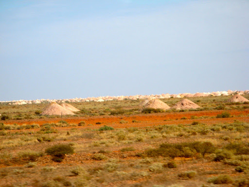
We called in at Coober Pedy for water, more last minute shopping of TWSF (Things We Still Forgot) list and fuel ($1.695). Sadly the cheap fuel place (Bulls) has closed down but the Mobil store half way though the town was much cheaper than the Caltex roadhouse.
North of Coober Pedy there are many flat topped mesa hills, part of an ancient land which is almost completely worn down except for very hard materials protruding from the surface, such as mesa hilltops and road signs.

6776975e-2012-09-9-00-00.jpg

J saw a burnt out double decker bus in a paddock, or it could have been a burnt out cattle truck, both of which performed the same basic function.
We stopped at Cadney Park for comfort break, but not fuel at $1.98
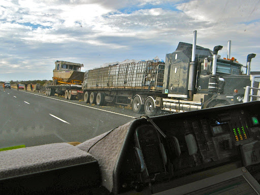
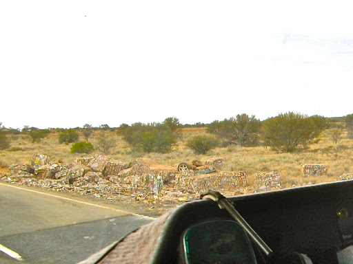
Later we came upon a police roadblock for an overturned road train trailer. Pallets of crushed cans littered the verge plus what appeared at first glance to be an upside down small car which we feared might have been involved in the accident. Fortunately I think it turned out to be a small car trailer probably fallen from the road train, since it only had 2 wheels. It looks like the 3rd trailer of the road train wandered off the bitumen and overturned, spilling it’s load. Some truck driver will have some explaining to do.

52d8a51a-2012-09-9-00-00.jpg
The 3rd trailer (far left) is upside down
96fe6084-2012-09-9-00-00.jpg
This was the load on the 3rd trailer

J claimed to have seen Sturt Desert Peas but this remains uncorroborated by a competent botanist.

We bypassed Marla since we needed neither fuel nor sustenance and camped at the Chandler Rest Area.
I couldn’t make contact with D and P on the radio due to base operator Robert taking up all the available radio time
We’ve done 431km today and 1081km total, in 2 1/2 days. Oka going pretty well, now cruises at 90kph quite happily (previously it was only happy at 80kph) but of course higher cruising speed equals higher power equals higher fuel consumption (7 down to 6 km/litre). The replaced injector pump seal and air filter housing presumably makes a difference.
8th June 
Only 314 km today but a pretty good day’s drive, passed into the NT but passed up fuel at Kulgera at $2.10 .
Called in at Erldunda for fuel ($1.97) and had lunch. They have emus to gawk at and Telstra coverage so we checked the internet and sent emails re dishwasher to MS and A.
We found our first flies today (or did they find us?), not too many and the sleepy winter variety, but a portent of things to come.
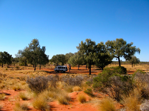
W drove down the Lassiter Highway to the Mt Connor Rest area for the night. A beautiful camp site amongst Desert Oaks.

4a5dfb6f-2012-09-9-00-00.jpg

We saw a “We Drive on the Left in Australia” sign, not outside an international airport or ferry terminal as you might expect, but on the Lassiter Highway in the middle of Australia! You’d think by the time motorists got this far they would have worked that out.
There were plenty of people at Erldunda, long queues at the pumps, but very few on the Uluru road, and almost no tourist busses whereas the area used to be infested with them. No more busloads of Japanese tourists. The Finke Desert Races are on this weekend which may account for some of the Stuart Highway traffic.
J doing washing, nice dry wind but cool and sunny. Everything dry by evening except woolly socks which always take days.
Tomorrow we’ll move to Yulara to do shopping, refill gas bottle, top up fuel and water and head out Sunday morning for the Great Gravel Central Road (GCR) west.
9th June 
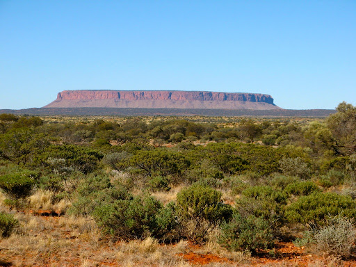
We stopped to look at Mt Connor, which is a very impressive mountain and we don’t see why it hasn’t been opened up for more tourism. It’s totally different to Ayers Rock or the Olga’s but in the same vicinity on the same road. In fact geographically the three are all aligned and about the same distance apart. It’s on private land so the only access is via a few specialised tours (flights etc). Surprisingly there is a nice but unnamed salt lake just behind the sand dunes north of the Mt Connor lookout.

37533d1a-2012-09-9-00-00.jpg

We found the dump point in the Yulara industrial area, near a bus maintenance facility.
Supermarket shopping at Yulara was pretty good and not as expensive as expected.
Topped up gas bottle (2kg for $9.90) and fuel ($2.13/l), both less than expected.
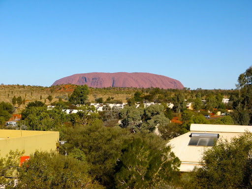
Walked up sand dune to see Uluru, saw lots of animal prints, surprising in centre of campground
Spoke with A on phone.

5a575709-2012-09-9-00-00.jpg

Radio reception was completely ratshit due to the electrical noise emanating from Yulara village so I just assumed D and P could hear me (which he could) and asked him to check Pauline’s Facebook page where I had written some notes.
D and P called later and we arranged a radio schedule 12:00 WA time (1:30 CST) the next day, to discuss a possible delay/route alteration due to storms in SW WA.
10th June 
Left Yulara campsite and passed through the NP entrance without having to pay the $25 per person entry fee since we had a permit to travel west on the Great Gravel Road. Nevertheless, we did a circuit of The Rock anyway in gloomy overcast conditions, quite unlike the spectacular sunshine of yesterday.
We struck out for the Olga’s in similar conditions but carried on west on the GCR. We reminisced about the “old” days when you could drive all around the domes of the Olgas and could even climb some, but not now, one road, one car park and only 2 defined walks you can take. That means that 90% of the Olga’s treasures can no longer be experienced. An unintended consequence of the Mabo decision.

ffd11557-2012-09-9-00-00.jpg

The GCR has mostly been regraded recently and was a pretty smooth drive for 150kms until we reached Docker River Aboriginal Community where it returned to its original corrugated sandy state.
But just after starting down the GCR, a large camel darted across the road in front of us. A couple of seconds later and we would have collided with him a-midriff. That would have been catastrophic for both him and us. A ton of camel has a lot of inertia and his body could have ended up in the cab and that would have been the end of our holiday, our Oka and possibly us as well, we have a bull bar but it’s not a camel bar. We never thought any of that at the time of course, we just stopped quickly, took some pictures and carried on.

de9620c4-2012-09-9-00-00.jpg
This is the very lucky camel that nearly ended our trip and dented his hump

On a good day the GCR would be a nice drive. It’s a wide, 1000km lonely gravel road which extends from Alice Springs to Laverton, but most people would never have heard of it let along driven along it. It’s relatively smooth (ie a fair bit of sandy/gravelly corrugations more suited to a 4WD but not caravans) and not a difficult or tortuous drive but it is very remote with only 3 or 4 roadhouses at 300km intervals with minimal facilities and absolutely, totally, nothing in between except a scenic desert environment. No Maca’s or RAA services out here, you’re completely on your own. And you need some (free) aboriginal permits to use it.
But the rain started soon after the camel incident, not a lot, just a gentle but annoying pitter patter on the windscreen, but it carried on like that all afternoon. (Post writing note: and all night). Fortunately the track is sandy so it hasn’t turned into a quagmire, yet.

e8594b6e-2012-09-9-00-00.jpg
The Great Central Road with a few spots of rain, otherwise a nice wide open track.

At lunchtime we stopped at Lassiter’s Cave, where, in January 1931 he sheltered for 25 days after his camels bolted taking all his possessions, food and water. He was searching for his mystical gold reef which he claimed to have first discovered 34 years earlier. He really should have noted its GPS coordinates.

36bfe5fa-2012-09-9-00-00.jpg

Anyway, after 25 days cave life, with only 1.7 litres of water and the support of a local aboriginal family, he started walking the 140 km east to Mt Olga (in mid summer) hoping to find his relief party. He made it only 55 km before he died, taking the secrets of his gold reef with him. We are travelling in mid-winter and none of the creeks we’ve crossed have any water in them.
Did I inherently know all this historical stuff? Nope, I just copied it off the signboard.
While at Lassiter’s Cave lunch spot we erected our big antenna and made contact with Dave and Pauline who were somewhere in WA, afflicted by the severe storms. Gravel roads on their planned route were likely to be affected by rain so they were seeking an alternative all-bitumen route to meet us on the GCR. We’ll contact them again tomorrow to reassess the situation.
We had noticed water leaking from the top of the main water tank while driving but not when we were stopped. I presume one of the breathers on top of the tank has either broken or got knocked out when we filled up with high pressure water from the Coober Pedy water facility. I need to investigate and fit something else to keep out the dust while allowing air to breath in and out, like a washing up sponge held on with aluminium tape or tie-wraps.
In the meantime we have no need to rush, and since the day was gloomy and damp, and we could see none of the interesting terrain, we stopped for the night at the Docker River campground, Kaltukatjara.

cfecdbda-2012-09-9-00-00.jpg

It’s potentially a nice spot, sandy camping areas set amongst weeping desert oaks and surrounded by red sand dunes, but sadly, like most things Aboriginal, it’s suffered from neglect, vandalism and lack of management. The toilets are woeful with no doors and there’s no water in the pipes. There is a full page notice in the entry hut apologising for the state of the campground and promising to rectify the deficiencies whenever they could but “it was hard work”. There is supposed to be a camping charge but they can’t even get that organised. Nothing has changed since we were last here in 2007.

file-153-2012-09-9-00-00.jpg

Fortunately J liberated a late issue of Women’s Weekly from the Yulara laundry so she has some very interesting articles and crosswords to do.
Contacted D and P, route still inconclusive, will contact again at midday tomorrow.
11th June 
Water leak turned out to be nothing more than water slopping about and coming out of the breather, both of which are present and correct.
The rain disappeared overnight and it was bright if not sunny as we headed west again towards the WA border and down to Giles Met Office (which runs on SA time). Nothing stirred there or at the Warakurna roadhouse.
We stopped at the junction of the Old Abandoned Gunbarrel Highway and called into D and P. They are coming up the GCR to meet us as their original route is too iffy, weather wise.
The GCR is now much better than our previous trips and is a 75-80kph gravel road if you keep an eye out for dips and sandy patches, and camels.

d586c0a5-2012-09-9-00-00.jpg
Camels on the Great Central Road

We stopped by Len Beadell’s Sandy Blight Junction Road plaque, even though it’s now 9km from the actual junction due to a road realignment to an aboriginal community.
Sadly I noticed an oil leak from the front diff so I’ll have to keep topping it up. Frustrating because I replaced the seals 2 years ago (which is a week’s work involving removing the differential assembly and all the hubs, bearings, brakes etc) and unblocked the breather pipe last year.

file-154-2012-09-9-00-00.jpg
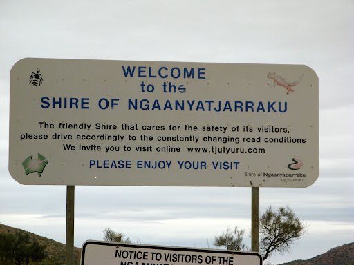
The Shire of the Longest Name

We passed through the Shire of the Longest Name but were saddened by the signs imploring us to keep unleaded fuel locked up or handed to authorities for safe keeping whilst in their area.
It got quite hot and sunny for a while, I even tried out the a/c, before clouds re-came-in and we finished the 300kms to Warburton. We refuelled at $2.43/l and are staying in their campground overnight, but apart from access to water, there are much better free desert campsites to be had.
Tomorrow we’ll meet up with D and P at Tjukayirla Roadhouse (which I call Chuckalolly Roadhouse), 250kms further west.
Continue our trek here, across 2500km of desert tracks to 80 Mile Beach.

Great Central Road to 80 Mile Beach

This blog section covers the West Australian desert tracks we travelled in 3 weeks accompanied by Dave and Pauline, Oka 137.


It includes the David Carnegie Road, the Eagle Highway, the Talawana Track, the centre section of the CSR from Well 24 to Well 33 and the Kidson Track out to 80 Mile beach.

Caution:


The total distance of these desert tracks is more than 2000 km, most of which should not be attempted alone, ill-prepared or inexperienced.

The only fuel supply between Tjukayirla Roadhouse on the Great Central Road and the North West Coastal Highway is at Kunawaritji at Well 33 on the CSR.

While the tracks were dry when we travelled them, after bad wet seasons they can become very boggy, washed away or impassable, and some are so narrow and overgrown as to be barely visible. The surfaces varied from very soft sand and sand dunes, to rocky with deep wash-aways and corrugations.

In dry conditions fire is always a risk so ensure all flammable material is cleared from your vehicle daily, and never park a hot vehicle on dry grass or spinifex (which can be 2 m high on the track). Many vehicles have been lost to fire in these areas.

These tracks are all very remote from any habitation or assistance so carry detailed navigation systems, adequate provisions, emergency communications equipment and a full set of recovery gear. Refer to other entries on safety gear and recovery equipment.

12 June (on the Great Central Road heading west towards Tjukayirla Roadhouse)


Saw a herd of camels wandering on and off the road. Camels are an ever present danger as they are heavy beasts and persist in using the tracks as walkways. Hitting a kangaroo may damage the front of your vehicle, but hitting a camel would destroy it.

Called D and P on the HF Radio at midday to ensure we coordinated out meeting this afternoon, they were about 20 mins ahead of us.

We were warmly met by D and P at the roadhouse after 18months of emails and 12 months of planning and they’ed even planned a shower for our arrival but we beat them to it. We explained that our mothers warned us about people we had met on the internet, they may be axe murderers. Little did we know that Dave had a big axe, chainsaw (and more) with him but we were obviously worth more to them alive than dead.

We fuelled up and headed up the David Carneigie Road, a much smoother track than expected (we were being fooled of course) to Empress Spring, an aboriginal water hole down a deep cavern.

Darkness beat us to the spring so we camped in a clearing for our first campfire and cool evening of chatter and wine, or maybe the other way around.


13 June


We found Empress Spring, its plaque and visitors book.

The only way down was via a steel chain ladder and none of us found the necessity to test its strength.

I noted our chicken-ness in the visitors book.


This very remote country out here and one slip could spell disaster.

Camel shooters had obviously been that way recently and left the remains of the beasts on the side of the road, we had to divert off the track to avoid them. We had wondered for some time how it was that camels always managed to die on the side of the track.


After the Well, the track became, as expected, a narrow 2 lane track but quite navigable, except for more mobile road blocks who will not get off the track, and why not? it’s a smooth direct route, unlike the prickly spinifex desert.


14 June


As we went further north into the Gibson Desert we met a plethora of wash-aways to contend with. We stopped at all the major ones and planned route for the wheels to take to minimise the changes of a rollover or getting seriously stuck. It was slow work but it worked fine so the videos look a lot smoother than the original path would have done. For some we had to divert off the track and create our own path around them through the surrounding scrub and spinifex.


The junction of the DCR with the Gunbarrel Highway


We met the Gunbarrel Highway later that day at Mangkili Claypan Reserve and started up the Eagle Highway directly opposite the end of the DCR.


A few km up this track we came across a sandalwood cutters camp where very friendly team of Fijian workers were busily cutting and pressure cleaning a huge stockpile of sandalwood for the aromatic and wooden ornaments trade. Since sandalwood is an Indian tree, we assume that there is an indigenous sandalwood variety with the same characteristics.

Sandalwood Cutters on the Eagle Highway

They all stopped work and introduced themselves and offered anything we needed from their well stocked supply cabinets. We only needed some water which they provided from a bore with an ancient and only partial reliable petrol pump though about 200m of leaky pipes. And very sweet water it was too.
We camped soon after at a clearing near a windmill and tank where Dave tried out his vertical inertia pump on the borehole. It consisted of a plastic pipe with a valve at the bottom and weights inside. When jiggled up and down in the water at the end of a long length of rope water was drawn into the pipe and when full (ie heavy) it was pulled up and the pipe emptied into a container. In the early days a camel it would have done the drawing up but I”m not sure about the jiggling process though.

Camp#1 on the Eagle Highway


After dinner we cracked open a bottle of Port to celebrate the start of our adventures. Can’t recall much else then until the next morning.


15 June

We had some problems with an errant shower tent this morning and eventually had resort to reading the instructions. This didn’t help much so muscle power provided the solution.


The recalcitrant shower tent


Stages of progression: 1, Struggle: 2, Read the Instructions: 3, Struggle some more: 4, Read the instructions again…

Eventually we got it back in the bag using brute force and cunning.

The Eagle Highway started off fairly clear but soon became badly washed away and as we progressed slowly north the track became more and more overgrown and eventually disappeared almost entirely in a sea of spinifex.
Somewhere there’s a track in here


We got stuck in these ruts up to the diff and had to reverse out and drive around the rutted section


Doing some gardening to form a route out of the ruts.

Several times we had to divert around deep gullies (one of which we got stuck in up to the differential) and it was very difficult to find the original wheel tracks once off the track.


This rock formation on the track looks just like a crocodile lurking

We didn’t know it at the time but yesterday’s friendly sandalwood cutter folks were the only people we would meet in 8 days of desert travelling from the GCR to the CSR.

It’s fairly easy to circumnavigate this sort of difficult track condition since you can see the terrain off the track…
…but for this sort of challenge you may have to divert a long way from the track around trees and over spinifex which might hide dangers that you can’t see, like gullies and tree roots.

We could not have followed the Eagle Highway route without our moving map system, and travelling alone or in a smaller 4WD, or in wet conditions, would have been extremely risky due to to restricted track visibility and deep washouts. Even our Oka’s with their high ground clearance and excellent visibility were barely adequate at times.


Wherethefookarewe?? If you deviate off the wheel tracks around an obstacle it’s difficult to find the track again

Sometimes it was easier to follow.


Where fires had removed the bush, the tracks were easier to follow


We tried in vain to reach Warri Camp this evening, a location where the last nomadic Aboriginal family had been located in 1977. Due to difficult track conditions and the setting sun on our dirty windscreens we camped for the night in a clearing and found the camp the next morning.

Campsite just south of the Warri Camp


16 June


Warri Camp is a a very remote location exactly centred between the Gibson and Little Sandy Deserts and south of the Great Sandy Desert. There’s nothing much there now but it’s easy to see how the indigenous people could have lived there undetected for so long. There were some rock outcrops where water holes would have been found and plenty of bushland for hunting.
The brief history of the Warri Site is:
In 1977, a Martu couple – Warri and Yatungka – were escorted in from the desert amidst the worst drought to hit the region in the twentieth century.


Their story dates back to the 1930s when the couple eloped from their community, living as exiles in the desert. Theirs was a love-match that was not permitted under Western Desert Aboriginal law, which prescribed strict rules regarding marriage and harsh penalties for those who would defy these laws.


After forty years in the desert together, Warri and Yatungka died shortly after returning to civilization, as did the master bushman Mudjon, their chief rescuer.

Nothing much at the Warri Camp now. The site has been used for subsequent construction activity as a truck loading bay had been built.


About 4km north of the Dragon #1 Well, the track meets a cut line (also called the Eagle Highway on maps) which leads south east to/from the Gary Highway. The north west continuation of that track goes nowhere. The Eagle Highway section we wanted heading north is supposed to be directly opposite the track we had come up from but was nowhere to be seen, even though it’s shown as such on the most detailed maps we had (NatMap 2008 1:250,000 topographic digital raster maps).

The tricky navigation challenge at the junction 4 km north of Dragon #1 Well

We tried the north west track for a few km without success and eventually located the actual junction of the track about 1/2 km south east at 24º 02.361′ S 124º 33.322′ E. It took us 1/2 an hour to locate the 2 thin wheel tracks heading north.
On Google Earth the original track due north can be clearly seen, but at ground level it has disappeared completely near the junction and an alternative track has been formed, presumably to bypass some track difficulties.
The original track due north on Google Earth

Several times along this track we had to stop and take stock and determine the safest route though. Often this meant deviating off the track to form our own side tracks through the spinifex and around impassable obstacles.
Me and Dave in discussion over how to proceed

Here’s a video of a diversion around a particularly difficult section. It meant negotiating a dry creek bed with a steep entry point.


This is Dave leaving the track to get around a wash-away…


…and this is Dave returning the the track.

Here’s a video of the Eagle Highway


Some creatures are quite happy living in this area. This web was as strong as fishing line and could easily support small branches.

17 June


We passed through the Connolly Basin to the the Talawana Track junction.

The Connolly Basin is an ancient meteorite impact crater, barely discernible at ground level as it’s 9km across and only 25-30 m high at the rim. It’s situated near the Talawana track at the top end of the Eagle Highway and was first determined as an impact crater by Eugene Shoemaker (a friend of Len Beadell) in 1985. It was Beadell’s track construction that allowed the Shoemakers to explore this region of Australia. [They also confirmed the nearby Veevers Crater (off the Gary Highway) as an impact crater in 1974].

On the map, the Connolly crater can be imagined from the series of dry gullies that drain into its centre from the surrounding countryside and from the almost circular contour line around it.


Ground Zero is marked by a cairn of stones and an old pole but you wouldn’t want to be standing there, 57 million years ago.

 
Both sides of a road sign at the northern end of the Eagle Highway
Looking back down the Eagle Highway. Doesn’t look so bad does it?

At the Talawana Track junction there is a glass jar packed with notes from previous travellers. We also put a cautionary note in the jar about the conditions on the Eagle Highway but J post-dated the note as 17 Sept instead of June, to avoid any litigation issues. I expect rude emails to start appearing soon.

Reading the notes in the visitors jar at the Eagle/Gunbarrel Highway junction

We passed by the remains of an old LandRover, the same model as we traveled around the world in, but in a slightly worse state of repair.


The Talawana Track is a typical Len Beadell track, straight, between sand dunes, and corrugated. We made a nice desert campsite alongside the track. At last it was starting to warm up a bit.


18 June


We searched out and found Midway Well, long since abandoned and overgrown. It was certainly an important water source to Aboriginal inhabitants and would have been a lifesaver to desert explorers.


Green and slimy it may look, but this could be the only surface water for 100km.

We also located a more modern well which had been fitted with a hand pump and trough. The water was so good and close to the surface that we decided that a lay-day was in order so we could do some maintenance before attacking the CSR and the ladies could do their (our) washing.
Midway Well and very good water


19 June


On the way out of the well site, we stopped to mark an old oil drum with the directions to the water for other travellers and continued down the Talawana Track. This was another example of never, ever passing by an oil drum, star picket or other signs of human habitation without exploring them. They are never put or left there without a good reason.


We passed by the wreck of an old trailer that only needed some wheels, a dab of paint and a complete mechanical overhaul to be as good as new.


20 June


Today we completed the Talawana Track and reached the junction with the CSR just short of Well 25. We left messages on the sign and were surprised to see a sign saying the track we had just come down was now on Martu Native Title land and access is completely prohibited but there was no sign at the other end.
Warning Rant Follows:We are getting disgusted that chick-livered governments and just handing over vast tracts of Australia to people who don’t need, and will never make use of the land. And in any case Rights Of Way should have been excised from the Native Title claims so access can always be made to these remote parts of the country. If it hadn’t been for the endeavours of pioneers such as Len Beadell, this land would never have been made accessible to the people who now “own” it.End of Rant

Once on the CSR (most of which fortunately is still a Public Access track), we were met immediately by a huge sand dune which caused us a few problems (videos to follow). Previous gung-ho drivers with smaller 4WD’s and camper trailers had obviously decimated the lead-ups to the dunes, spinning their wheels and leaving large uneven hollows we had to bounce up though, threatening the suspensions of our 6 tonne vehicles. Being the first large dune we had come across on this trip, we had to adjust the tyre pressures, speed and gearing to get over it successfully. Ironically, we had both done this section of the CSR before and don’t recall this dune being a problem, an indication that overuse is adversely affecting track conditions.


This a very high and steep sand dune, with soft sand all the way and deep hollows to bounce in and out of.


Parts of the CSR were a bit tricky…

But we overcame that dune and many others that day and met our first other travellers in 8 days. It had been a pretty lonely but satisfying journey since leaving the GCR 8 days previously.

Further up the CSR is Well 25 where I relocated a tree that I first reversed into in 2007. It’s wounds have healed up but my memories haven’t.

I wanted to visit Well 25 since I had an altercation with a small tree there in 2007 and wanted to relocate it to see how it was doing. I had reversed into it on our first drive down this part of the CSR in 2007 and broken the rear gate. We had to stay the night there to fix up the damage.
The tree I reversed into in 2007


We relocated the same tree and found it had recovered far more easily than my memories had, and there was no scaring left on it.
 

Well 26 has been completely restored in the last 2 years and was buzzing with people.
D accidentally kneecapped a fellow tourist with the handle of the well bucket handle. We lowered and raised the very heavy bucket using the windlass several times collecting water but one other traveller misread how heavy the bucket was and the handle got away from him and hit his leg just below the knee, laying him out cold.


The kneecapped traveller receiving first aid from Dave, a bucket of cold water…


…and then receiving attention from a nurse. He seems perkier somehow, must have been Dave’s cold water.

Fortunately his leg didn’t appear broken, just very severely bruised and we administered what first aid we could in these circumstances (cold water and ice packs and told him to keep up his fluid intake) but it was still 15 minutes before he could get up and hobble away. There were a couple of nurses in his party so hopefully he would recover OK but driving and walking would have been a painful exercise for a few days.


The bucket, windlass and steel cable are very heavy, even empty. They hold around 30 Litres of water


We made camp at the foot of the Slate Range of hills.

Later I fell into deep do-do for successfully burning J’s favourite piece of pork fillet on the campfire and she was sorely not amused. Fortunately it tasted superb and I was eventually forgiven.


21 June


Today was our only cloudy day of the trip and it was bitterly cold and windy as well.

We explored the Slate Range, Well’s 27 and 28, both of which are in ruins, and made an early camp with a roaring campfire. We engineered a warm throne seat that we took turns in occupying.


At least the receding clouds made for some stunning sunset photos.


The toughness of the track was contrasted by the beauty of the desert sunsets.


22 June


Today we explored Thring Rock. We have no idea what a “Thring” is and how you use it but it was very cold wandering around it’s fringes.


Thring Rock from atop a sand dune

Sand dunes are getting a little easier as move north but the triple headers still demand some respect.

We also explored Well’s 29 and 30 and made camp at Well 31.


23 June


After a few last large sand dunes (which caused one of our party a few problems, but not me), we made Well 32 for lunch and then headed over the well known very corrugated section of track towards Well 33 and our final destination on the CSR for this trip.


This well had been restored by the Kunawaritji community and has beautiful water. There is even a small lake with birds and green grass surrounding it. We camped at the nearby campground and copious amounts of washing were done.


24 June


This was an enforced lay-day since the community is not open on Sundays and we need some fuel to get us to 80 Mile Beach up the Kidson Track. So we did some more washing, a bit of maintenance and a lot of lazing around until it was Happy Hour time again.


25 June


We fuelled up at the Kunawaritji Community (at $3.40/litre, served by Maurice, a very engaging Aboriginal worker), bought a few supplies at their much improved store and headed down the Kidson Track.

The first 100 km or so are in very good condition since it forms the now main (gravel) route from Alice Springs westwards to Marble Bar and Port Hedland. At the junction on Lake Auld, the real Kidson Track branches off north and immediately becomes a 2 lane desert track again.

J complained about the need for so much skin moisturising cream and claimed that it was because “the water was so dry”.

Didn’t quite make Razor Blade Bore so we camped in an old gravel scrape, not flash but better than spinifex.


26 June


A dingo came to visit us at breakfast time.


There were no babies here so after inspecting our domestic arrangements he moved on.

Met a team at Razor Blade Bore doing “cultural survey” for a mining operation in the area. This involved driving and flying a group of indigenous people around in a helicopter (at our expense) identifying sites of significance. Obviously they were easier to find if everything was burned to the ground.

While in the air the helo pilot dropped phosphor bombs to burn the vegetation. The result was a landscape which resembled the Kuwait oilfields after the Iraqi tourists left in 1991, and some of the fires were dangerous close to the track.
In this remote location, we could see no reason to burn the vegetation except for long established cultural reasons which are now completely irelevant. The local indigenous people now do their hunting and gathering in exactly the same places that we do, Woolies and Coles.

Sometimes the fires got dangerously close to the track, especially if you have a canvas camper on the rear of your vehicle


Had the usual difficulties with wash-aways and had to build several side tracks to get around them.


Reached Swindell Field, an abandoned WAPET airstrip and camped at the end of the runway where we had a good view of the fires but where they couldn’t creep up on us overnight.


27 June


Had a real struggle with a couple of sand dunes which had been capped for trucks in the 1980’s but had been badly washed away. (Dave used to drive road trains over these roads but they’ve deteriorated somewhat since then).


We had to do some extensive gardening before we could make a safe passageway for the wheels to avoid a potential roll over. It took us about an hour to complete the job.Here’s a video of our attempt at climbing the washed-away section of the sand dune.


It doesn’t look so bad in the video because we’d done our homework and planned ahead, but it was also on a steep part of the dune.
This is the same sand dune from another perspective but low resolution.


On the other side there were also potentially dangerous weak points along the edges of the track we had to avoid.


Dangerous wash-aways could have caused a roll-over

Found and old windmill and tank where we had lunch but there was no water available. However we did find an old tractor with a Perkins engine in it, albeit an earlier vintage than ours.
 

Camped at the foot of a Rocky Outcrop in a very nice sheltered clearing.


28 June


Did some maintenance on Dave’s windscreen wipers which decline to pass 20º without blowing fuses. It took an hour of dismantling but we removed the self-parking mechanism and it all worked again (except of course for the self-parking mechanism).

Our apprehension about the track conditions evaporated completely today after the appearance of a grader. We had heard that the track was being graded from the Coastal Highway end but didn’t realise it had reached quite so far. According to our sources, the grading will extend 400kms from the highway (including the difficult sand dunes) and then a further 80 km off the track to a mining site. Sadly this will ruin the Kidson Track as an outback adventure for years to come. Only the 100km from Telfer Road junction at Lake Auld to the the start of the sand hills will remain a narrow demanding track. It also appears to now be a Martu Native Title area (hence the earlier “cultural surveys”) and restricted access notices are appearing.
 

Dave met an old mate driving a grader that he hadn’t seen for 31 years. We stopped in the middle of the track for a chat.


We came across 2 huge rolls of steel cable that had fallen off a truck 50 years ago and were too heavy to recover. They are still there and are marked on the map.


2 huge rolls of steel cable that have sat here for 50 years

Disparaging remarks by a construction engineer we met about indigenous activities in the area were apparently quite OK because he claimed he was a registered racist.
 

Camped alongside a construction company bore and “turkey nest” (a small dam made from a raised ring of dirt and lined with plastic). This wasn’t flat but was the only non-spinifex area in a hundred km.


29 June


Thousands of budgies came at breakfast time to drink and the noise of their wings while hovering over the water was surprisingly loud.


Here’s a video of the budgies as their flock increases in size, wheeling and swirling like an immense school of fish, until a hawk appeared and they were gone.


We completed the Kidson Track and met the busy North West Highway, our first bitumen for 2500 km.


We drove straight on across the highway and on the 9km into 80 Mile Beach to complete our journey to the sea.


The view of the blue green sea after weeks of red desert sand was spectacular


Dave and Pauline frolicking
Segway-ing in the surf at 80 Mile Beach


After lunch and a frolic on the beach it was white knuckle stuff as we raced down the highway at 60+ kph towards Port Hedland.


We camped at Pardoo Roadhouse for the night so we can have a final drink and dinner out without the usual campfire, washing up and packing dramas.


Real grass to camp on, washing machines and flushing toilets. We had forgotten such things existed.

“Save a Horse, Ride a Cowboy” was emblazoned in dust on the back of a dirty horse-box.

Had fresh fish and chips made from freshly thawed fish, and apple pie with ice cream. No too bad considering our location.

Opened and completed emptied a bottle of red wine I had carried from Adelaide and handed back all the things we had borrowed from D and P and vice versa.


30 June


We drove on to Port Hedland, which is never a pretty sight, being a very busy iron ore exporting town, with dusty trucks and mining utes everywhere, and down to the shopping centre at South Hedland.

Sadly, we parted company with Dave and Pauline outside South Hedland shopping centre after 3 great weeks of fun and scary bits across 3 deserts and 5 outback tracks. They are heading back to Perth down an inland route and we are heading to Ningaloo for a few days snorkelling and R and R before heading north via an inland route to avoid the caravan crowding and mining activity on the coastal highway.
Continue out trek here down the coast via Ningaloo and Waroora Station to Carnarvon.
Port Hedland to Carnarvon

1 July 

Called into Karratha to refill the gas bottles but it was a Sunday afternoon and everything had just shut. We tried all the industrial areas, the hardware shops and even an Adventure Sports shop, same story, “Never on Sunday”. 

On the way out of town we spied a Big 4 Caravan Park, not noted for their economic rates but gave them a try anyway. Sure enough, “No problems, I’ll do it straight away”. The old guy came back staggering under the load of 2 full gas bottles “3Kg are they?”. “No they’re 4kg” (and I kicked J since they are actually 4.5kg). So away he went and happily charged us for 3.5kg bottles. Go figure. However our joy was short lived as one of them started leaking and we lost a fair bit of gas before we noticed. The old (and obviously inexperienced) filler had failed to tightened one of the valves properly.

Camped at 40 Mile Beach campgrounds that Dave had told us about, just past Devil Creek about 20km south of Dampier, and run by Roebourne Shire.


Only $7 for ocean views (beyond the mangroves) and plenty of seclusion and sunsets. Worth a longer stay one day. The caretaker lived on-site and we had some difficulty finding his van, but eventually his veggie patch gave him away. He thought the large sign out the front reading “Caretaker” should have given us a clue.


2 July 

The most boring of scenery as we drove south, almost featureless grassy plains and a few low hills. We played guess the height of the microwave towers which appeared every 30km or so. 

Drove down past Nanutara Roadhouse, which was out of diesel “It’s coming in either 10 minutes or maybe an hour”. OK is there some water we can fill our tanks from then? “No”, and he walked off. So we drove off taking our custom elsewhere. 


There is a lot of new mining activity in this area, judging by the huge new haul roads that are being built.


Camped at Yannerie River rest area in a huge flat expanse but well serviced by a dump point, clean toilets, BBQ places and tables and chairs. 


3 July 

Drove the remaining 250km into Exmouth amongst improving scenery and full of expectations, filled up with free water at the visitors centre and then passed a sign saying that all campgrounds in the National Park were full. Bummer. 

I got very frustrated as all the caravan parks in Exmouth were also chockers and we almost abandoned Ningaloo for this year, but having driven 1000km to get down here from 80 Mile Beach we gave it one more chance. 

We ignored the full signs and drove 50km around to the park entrance and happily there is a caravan park (Yardie Homestead) just outside the park, which had some economic unpowered vacancies so we checked in for 2 nights. 

I was further cheered by a very helpful (and pretty) park ranger on the entrance gate who told us that the entrance fee was halved for concession holders, although she doubted that we were old enough anyway (bless her little King Gee work shorts). 

We were amazed at the large number of people sitting in and milling around the caravan parks instead of out enjoying the reef. Out on the beaches and reef there were relatively few people.

So we went snorkelling at the almost deserted Turquoise Bay a lot happier than earlier in the day. J even saw a shoal of large silver fish.


A large American lady claimed her daughter saw a blue ringed octopus but I doubted that, as I thought they were a QLD speciality. Correction, they do live in all Pacific and Indian ocean tropical areas but I still think it’s unlikely that’s what she saw. But when I read the words “no antivenom is available” and “10,000 times more toxic than cyanide” in the same sentence, I vowed never to go near one. 

From Wikipedia: The blue-ringed octopus is 12 to 20†cm (5 to 8†inches), but its venom is powerful enough to kill humans. There is no blue-ringed octopus antivenom available. The octopus produces venom that contains tetrodotoxin, 5-hydroxytryptamine, hyaluronidase, tyramine, histamine, tryptamine, octopamine, taurine, acetylcholine, and dopamine. The major neurotoxin component of blue-ringed octopus venom was originally known as maculotoxin but was later found to be identical to tetrodotoxin,[4] a neurotoxin which is also found in pufferfish that is 10,000 times more toxic than cyanide.[5] Tetrodotoxin blocks sodium channels, causing motor paralysis and respiratory arrest within minutes of exposure, leading to cardiac arrest due to a lack of oxygen. The toxin is produced by bacteria in the salivary glands of the octopus.[6] 

4 July 

Went snorkelling at Oyster Stacks this morning, very good but difficult to enter the water off the sharp rocks with the sloshing of the waves. I got a bad graze on my left hip and remember thinking “That’ll attract the sharks”.


But all was well and I took copious photos of fish and coral (but no blue ringed octopi) with the Kodak underwater camera we bought at the visitor centre only this very morning. Sadly, the Exmouth processing center is closed for a month so they’ll need to be developed somewhere else.


Oyster Stacks at Ningaloo Reef
Me snorkelling at Oyster Stacks

Later we went down to Yardie Creek and took a walk along the cliffs over the creek for spectacular views of the reef. We saw a bower bird along the way.


The sand bar crossing was bone dry this year, unlike 2007 when it was a foot deep in soft sand and salt water. Fortunately we didn’t need to do the crossing again but we have done it before in the LR.


The sand bar across Yardie Creek
Apparently cyclones or ultra high tides can breach the 100m wide sand bar which usually separates the creek from the ocean and then sharks, turtles, rays and dugongs can enter the creek where they are trapped for several years before the mouth is opened once more. Cyclone Vance dumped 250mm of rain in the area in1999 and the creek mouth was open to the ocean for 3 years.


On the way back we called into Turquoise Bay again and J did some serious snorkelling for the first time on the Drift Loop and enjoyed it. I used up the remaining photos on her efforts. Now we have to go back there again tomorrow.

My thumb now hurts, a combination of salt water and dry air which has cracked the skin alongside my nail. I thought you should know this.

Had a really clear radio hook up with D and P tonight and it’s quite heartening to hear the radios that I had resurrected talking to each other so well over a long distance. 

5 July 

Had to venture into Exmouth today to sort out a Centrelink problem. The lady in the agency claimed her computer was a male since it took a long time to warm up and could only do one thing at a time. I suspended my armed response since she fixed our problem immediately by bypassing the normal 1 hour wait on the phone queue. 

Checked out the facilities at Worroora Station south of Coral Bay for coastal camping. They only have 51 km of Ningaloo Reef as their western boundary so I’m sure we’ll fit in somewhere. We’ll head down their tomorrow for a few days. 

Bought fresh prawns from the Kallis fisheries shop in the Driftwood Centre and did some inevitable supermarket shopping. 

Scott called whiIe was sending him an email so we had a long chat instead. 

Filled up one side tank at the Vlamingh Head Caravan Park since it was 6 cents cheaper than in town. 

Went back to Turquoise Bay for more snorkelling. J did very well, drifting over a garden of coral well out of her depth for the first time.


6 July 

Left campsite to head south. Bought fuel again at the Lighthouse CP, 6 cents less than in town. Called in to visitor centre to get water and met Dave and Janine in Oka 134 for an hour. 

On the way out of town I photographed a very tall emu crossing the road…

Checked emails and headed south to Bullara Station overnight. OK but not brilliant for a rustic cattle station. Had BBQ and campfire chats with several ladies who retired to bed at the very late time of 7.30. Met Pauline (late 20’s) travelling alone with her 3 year old son in a small motorhome. Brave thing to do but she seemed very level headed about it all.

Mt thumb has been hurting again. I really must do something about it.

7 July 

Drove down most boring countryside, grey sand hills covered by grey spinifex and nothing else. 
Past the Coral Bay turn off (apparently very crowded) on to Warroora Station. Very bad track but we found the final campsite 50m from the beach. 


The beach on Warroora Station
Rigged up Yagi antenna to get Coral Bay Telstra network and got good email, from D and P at home and 2 emails from Mark frustrated due to difficulties in fixing my rear car electric window which keeps falling down.


Uploaded some more photos

8 July

I decided my thumb has been troubling me for long enough and wasn’t improving. It was making me very depressed and grumpy (so I’m told, I hadn’t noticed) so this morning I resolved to fix it (we were several days away from the nearest doctor) and did some surgery to remove the piece of flesh which had emerged from beneath the nail. It had an exposed nerve in it which made me jump every time something touched it.

Before surgery…

I sterilised my Swiss Army knife blade in a flame, covered the affected area with antiseptic cream and cut off the offending piece against the nail. It was quick and bled a bit but didn’t hurt too much. A tight plaster and it was left to heal.

…and after.

Trolled down to Sandy Bay for lunch and a look around. Nice sandy campsites along the beach, all full up, as was the overflow camping area.Went further down to Pelican Point along a very sandy track. All alone on a very remote beach after a boat trailer squeezed past us. Apparently they had been fishing illegally, as Pelican Point is a sanctuary and all types of aquatic hunting and gathering are banned in that area.

The track to Pelican Point
We found a beautiful, still hinged oyster shell on the beach, complete with real pearls inside (albeit very small ones), which we hunted and gathered, probably illegally.

Now how did this oyster get here on the beach without illegal hunting and gathering?

Nearly staked a tyre on the way out on a tree stump hidden in the shadow of a clump of grass on the side of the track. Fortunately it only grazed the tyre wall.

The bruised tyre…
…and the hidden tree root

Had a nice walk on the beach and J nearly got beamed up in the sunset.

9July

My thumb is much better today, since you asked, and I can almost use it for the space bar again. My surgery has worked well and I now feel confident to take on more complex surgical tasks, like shaving or gall bladder removal.

We moved to a more sheltered campsite nearer the beach and on sand, not prickly grass. Dug some sand out from beneath the front wheels to level things, and I was surprised how easily the wheels sank in as I removed sand from behind them. I wondered if lifting it up could be accomplished as easily by piling sand up against the wheels.


Had a lay day to catch up on reading but after lunch simply had to exercise some muscles so we walked a long way up the beach and found clam shells amongst the rocks.

Had a good happy hour with neighbours, some of whom stay here for long periods each year.
The campsite hostess and Mr Hostess live hear all year round in a small caravan, even when it reaches 55º and the sandflies are biting. Don’t think I could do that, however enticing the ocean views are.
Don’t forget to mention the quails….

10 July

Another lazy morning but eventually we had to move so down along the beach again we went.

As we walked along the beach we watched whales breaching and sploshing just beyond the reef.


We also watched a green turtle feed on sea grass a few meters from the beach and coming up for breath every few minutes.


But happy hour was cancelled today since a cool, wet gale blew in from the sea late in the afternoon and it was windy and rained lightly all night.

11 July

Sun came out in the morning as the dark clouds moved on to ruin someone else’s holiday and we put all the outside furniture in the sun to dry off.

Packed up and drove down the coastal tracks through Warroora Station and stopped at a PGL (Pretty Good Lunchspot) overlooking Stevens Beach.

PGL overlooking Stevens Beach on Waroora Station
The track down to Stevens Beach
A composite photo to Stevens Beach from high up on  dune

We watched dozens of whales in small pods as they made their way up the coast, sploshing and “thar she blows-ing” on the way.

Pods of humpback whales blowing as they make their way north outside the reef

Had to leave Warroora Station eventually and made our way to the main highway, south through Minilya towards Carnarvon. Camped at a rest area about 80kms north of the town.

But my thumb is now entirely healed and trouble free. A breakthrough in outback medical science and a plus for my Swiss Army Knife.


12 July

Drove into Carnarvon and around the town. It’s very spread out with several caravan parks, 2 hardware stores and copious numbers of “No Camping” signs.

We did our usual trick emptying of supermarket shelves (Woolies) and found a very average Caravan Park with NO unpowered sites. Warning: Rant Follows: Unpowered sites are fast disappearing from CPs, due we are told, to the number of backpackers who stay in unpowered sites and then connect up with extension leads to steal power. Sounds like a very weak argument for not being able to manage a trivial problem and abandoning self sufficient travellers who don’t need and can’t use mains power, just to charge $4 a night extra, and NO pensioner discount either. My faith in Caravan Parks, such as I had, has taken yet another beating.

Continue our trek here, via the inland route through Gascoyne Junction, Mount Augustus and Nullagine to Marble Bar.

Carnarvon to Marble Bar

13 July

More shopping at IGA, had the usual gas bottle run-around but eventually Mitre 10 filled it, and filled up with diesel at Woolies.

Talked with Mark re money and the cat who had escaped.
Left after lunch east to towards Gascoyne Junction.

 Camped at Rocky Pool, a nice rocky (obviously) section of an otherwise sandy river bank, with a huge pool of rocky water about 1/2 km across. A few other hardy travellers were also there since the rocks did not lend themselves to camping.

Rocky Pool
Our campsite at Rocky Pool

14 July

Scruffy scenery all along from Carnarvon has obviously been scarred by widespread flooding
Gascoyne Junction has a pub, hotel and fuel outlet no more, it all got washed away in the big flood of 2010, after standing for more than 100 years (although the plaques outside withstood the flood’s ravages OK and still promote the pub as THE place to be seen in Gas Jct, as if there were any others). The flood must have been a km across and 50m deep to do that much damage. [Officially 12 inches of rain fell in 4 days, which was 60 times the monthly average and caused the river level to rise from a dry river bed to 8m above normal within 2 days].

The 100 year old Gascoyne Junction pub and service station used to be here, until the big flood washed them away…
…but the plaque survived.

Sir Charles Kingsford Smith, late of aviation fame, made his name in Gascoyne Jct and used to frequent this pub on his rounds as mail courier and transport carrier from Carnarvaon to Meekathara, according to the surviving plaques.

New town buildings are being erected higher up from the river, I mean we don’t want the shire offices or the public toilets to disappear in another spot of rain.

Had a look at Kennedy Ranges over the Gascoyne Jct river crossing but decided to try tracks new to us to the east instead.

Excellent drive east of Gas Jct, very interesting scenic drive through Glenburg and Dalgety Downs but a bit too long and we only just got to the Gascoyne River crossing before dark into a previous camping area Dave mentioned to us, one of the few places where we could pull off.

One reason we were behind schedule was the 1/2 hour stop to look for (and acquire) some fossils from the Pliocene era that are scattered along the roadside. I believe them to be fossils of gnathostomulid, but I could be wrong.

Gnathostomulid fossils? You be the judge.

15 July

The Gascoyne River crossing has an interesting flying fox for getting the mail through, a good piece of bush engineering for when the river was in flood in the pre-internet period.

A flying fox, circa 1910
I spoke with a fellow on the HF radio today who had arrived at the same well on the Talawana Track that we had re-discovered 3 weeks ago (Midway Well). We had told him about it and where to find it in a previous radio hookup. He agreed it was a superb find and jettisoned all his existing water and refilled with Midway Well water since it was so good.

It’s not often that you can drink water straight from under ground which tastes sweet and doesn’t cause you immediate gastric problems, but this is one, and the only source of fresh water for 100km in any direction. There are many other similar wells we’ve come across in our travels but it’s a good idea to filter or boil all under ground water anyway. Surface water should always be treated more respectfully since animals (and humans) will have access to it and may foul it.

Good smooth drive up to Mt Augustus and we stopped to look at some aboriginal carvings around a Gnamma rockhole, a place where rainfall collects in deep pockets and can provide a useful source of water long in to the dry season.

We did the 40km loop drive around the Mount and had lunch at a picnic spot at the base of the rock after a 3.5km surprisingly rough track in.


Mt Aug is a very impressive lump of rock, especially with a dark blue sky behind it, it’s much larger than Uluru but covered in green bushes and trees. Claimed to be the largest single piece of rock in the world. There is a walking track up to the top (1106m) but fortunately we didn’t find it.

Mt Augustus from afar

We found a dingo lazing on the track in the shade of a tree. As we passed by she got up and wandered lazily in a big circle and lay back down lazily under exactly the same tree after we had left. She lay with her front legs crossed, just like our Bella used to do. Bella had quite a number of dingo genes in her and the similarities become more obvious every time we see a dingo.

It’s a bit distant but you can see she’s crossed her legs in a very lady-like manner, just like Bella used to
The Dooley Downs track north from Mt Augustus is very scenic but quite rough, even though it’s been recently graded, due to the large numbers of twists, turns, dips and creek crossings (all dry). Definitely not a caravan track.


Dooley Downs homestead, about 40 km north of Mt Augustus appears deserted and almost tumbledown, but seems to have all the modern facilities, a large new communications mast and a satellite dish next to an old windmill. But there appeared to be nothing happening there, maybe stations have merged and this outpost is no longer needed.


Camper Trailers and stuff falling off, twice.

Stopped to assist a camper trailer with a flat trailer tyre but they had already fixed it and were packing stuff away.

A couple of km further on another camper trailer (CT) came roaring around a corner towards us in a cloud of dust (CTs always make more dust than a 4wd, presumably due to the extra set of wheels to distribute the dust stirred up by the first 2).

Another couple of km further on, there were 3 lumps in the middle of the track so we stopped to remove them. They were 2 tents and a tarp, presumably from the aforementioned CT. I piled them on the roadside and tried calling in on UHF Ch 40 several times but no one answered. However, the CT which had the flat tyre then appeared and said it was their friends’ (who had just passed us) stuff that they had come back for, it sounded logical so we carried on and they presumably picked up the stuff and turned around since they never came past us.

Stuff I piled up on the roadside
We did wonder why the 2 CTs would be heading in different directions if they were traveling together? Fact is stranger than fiction, and was to get stranger.

Yet another couple of km further on again and there were 2 more piles of stuff on the track, this time another tarp and a picnic chair which had shattered and distributed its aluminium legs all over the track. So I made another roadside pile and left them for someone else to come back for. If there had been any more stuff left on the track I was going to charge for my efforts and buy someone a rope.

Second pile of stuff.

We are camped on hillock near 9 Mile Pools on Pingandy Creek (no water) about 85 km NE of Mt Aug. where a grader has kindly left some tracks across the rocky terrain. As always, there will be a much better campsite just around the corner (but luckily there wasn’t or for the next 50km).

16 July

Up at dawn for some photos. No wind and it was quite pleasant.


The surrounding scenery is very neat, comprising spinifex rings and small trees, all set is a landscape of bare rocks. Not good as a veggie patch though.


Completed the excellent Dooley Downs track. It was extremely scenic although a bit rough in parts.


The junction with the Ashburton Downs-Meekatharra road is one of those huge Y junctions about 1km across each side.

The A-M road scenery changes from red rocks and spinifex to white rocks and grassy tussocks. The coloured breakaway’s are very reminiscent of the Coober Pedy area.

The Ashburton river covers a huge area when in flood and in 1997, the flood level was around 5 m above the road level, which is several km from the normal river bed. That would make the river more than 5km wide and probably hundreds of km long.

We’ve seen Wedgetails eagles today and several dingoes which were a bit thin and scrawny looking. At least they are not eating the 1080 poison baits (with added strychnine, according to the warning signs).
Plenty of dusty creek crossings and river plains and flat topped hills but the most striking were the Beasley Pinnacles which had pointed peaks.

Beasley’s Pinnacles
We crossed the Tropic of Capricorn again just before Ashburton Downs Station but with no signs or fanfare.

Camping about 15 km short of the Nanutara-Wittenoom highway, 100km south of Tom Price
D called up and advised us about water and gas refills in Tom Price.

17 July

Good road for most of the way to Tom Price except for a 40km rough section which bypasses Paraburdoo.

Tom Price is a very green clean town that used to be a closed mining town that was opened up in the 80’s. It has a good Coles supermarket, Coles express fuel outlet, free water and good facilities (except for the crappy expensive caravan park which fortunately we don’t need).

The shopping was surprisingly friendly and cost effective and the service station gives 6¢ Coles discount even though there’s only one supermarket in town and only one fuel outlet, so they don’t need to.

We filled up the water and fuel tanks, and the pantry for the next stage of our trek across to Nullagine and up to Marble Bar. Could be a week or more between shops.

Sent Alan a happy birthday email which he wasn’t supposed to open until tomorrow but he called right back. As I was talking to him I found a 5¢ piece on the ground and he said “Now you can afford to buy me a birthday present”. I told him I wasn’t intending to spend that much.

The scenery around Tom Price and the Pilbara area in general is quite spectacular with lots of quite high mountains and deep green valleys, although none have any water in them.


The Karajini National Park is close by too but we’ve been there a couple of times so we are giving it a miss this time.

You would hardly know that some of the world’s biggest iron ore mines are in this area, although a huge ore train came past just as I went in to pay for fuel and 5 minutes later as I came out it was still going past. 30,000 tonnes of train (4 locomotives and over 200 ore trucks) is not something you want to get in the way of so it kind of makes sense to obey the crossing signals. Rio Tinto have 32 such trains working around the clock, one every 25 minutes.

Each train is operated by a single driver, and comprises up to 234 ore cars, each ore car with a load capacity of approximately 112 tonnes. A fully loaded train weighs approximately 31,000 tonnes and is about 2.4 kilometres in length.
FYI, BHP run even longer trains and hold the world record for the longest ever train, 7.35km, 8 locomotives and 684 ore trucks, weighing in at 99,000 tonnes. It broke the couplings between trucks (what a surprise) but successfully made the 275km journey from Newman to Port Hedland in 2001.

The road north from Tom Price is visitor free but dusty gravel for much of the way.

 Heavy mining trucks throw up a lot of dust…
…and then you hope no one is coming past them.
Camped at Rio Tinto Gorge, a not at all signposted camping area near, well, Rio Tinto Gorge.  It has beautiful scenery, fresh air, a campfire, seclusion and internet service. What more could one ask? To be free? Well it is free, as well as being priceless.

Our priceless but free campsite at Rio Tinto Gorge
Had the double bonus of talking with Dave on the radio and emailing him at the same time.

18 July Happy Birthday Alan

Drove through the Rio Tinto Gorge where vehicles have to call in on Ch 40 to ensure they don’t meet head on. Very nice scenery but the road was very dusty, with several wide load mining trucks that we had to pull over for.
We passed by Wittenoom with all it’s asbestos warning signs and we didn’t venture far into the gorge. A pity because from photos, Wittenoom Gorge is extremely scenic, like most of the Pilbara hills. It’s a shame that such a nice area has been forever tainted geographically and medically with the asbestos catasrophe. The town has been abandoned but all the houses, shops, vehicles and gardens still remain, too dangerous or politically difficult to deal with.
You need respirators to venture further into Wittenoom Gorge
Would you buy a Hot Dog from this Wittenoom Deli?
At the end of the dusty road is Auski Roadhouse (now called Munjina). It’s a large rambling outback service station cum caravan park with a huge forecourt, large enough for a triple road train to do a U turn in.
We needed nothing there since we filled up everything in Tom Price and are now traveling on the Woodstock-Marble Bar road. We should however be travelling on the Hillside-Woodstock road but due to a minor error of navigation and the fact that someone had stolen the road signs, we are not.
Roadsigns like this make navigation difficult
No matter, it’s very interesting and scenic anyway and we can get back on track from Rocky Island on the Shaw River to Hillside then thence down the planned Bonnie Downs track. We failed to find either the Motor Car Well or the Dead Bullock Well but we did find a number of dry waterholes and creek beds, and plenty of rocks.
Our abandoned tin mine campsite had to be abandoned since we failed to find the minuscule track leading to it. All roads apparently lead only to Marble Bar.
Maybe a little bit exposed but it was warm and still and no one could see us from the main track
We are camped instead on a small track about 1km from the main track in a open rocky clearing surrounded by a sea of spinifex. Fortunately it’s warm and not windy and there’s no one for miles. Neither is there a phone service.
But the sunset was pretty good…

19 July

A warm but cool night in our open campsite. Fans on for 1/2 the night and then doona’s up around the ears for the other half.

…and the sunrise wasn’t bad either.
Had a bran-free breakfast today to give my insides a break. I observed that unattended Weet-Bixes (Weet-Bii?) harden faster than QuickSet cement, but probably taste similar.

Started a competition to recall the worst ever cup of tea. Today’s reconstituted tea leaves rated fairly well, but we still think that an earlier event whereby a fresh pot of tea was made without noticing that the pot still contained the previous day’s half teapot of cold tea, probably leads the race.

J noticed that there weren’t many birds around here. I suggested that there wasn’t much for them to eat, but that I had spied some dingo footprints. Well what do dingoes eat then? Birds, obviously, otherwise there’d be some. You don’t need a PhD in zoological sciences to travel the outback but it would probably help.

Our campsite at dawn
We completed the track to Rocky Island and in doing so, we successfully found 2 tracks which have now completely ceased to exist. 

At Rocky Island we had to cross the Shaw River, one of the widest rivers we’ve seen, almost 1km across but almost totally water-free.

The Shaw River (a still from the forthcoming movie of the same name).
From there we headed south to Hillside, our original destination before the navigational error crept in, then down the Bonnie Downs track. In the 80km to the Nullagine-Marble Bar road, we saw not a single person, unlike the previous 150km when we saw at least 3 or 4 vehicles.

The Nullagine Road is another thing alltogether (or getheralltothing as my mate Charles is fond of saying).

Warning, Another Rant Follows: Dozens of CT’s stirring up the dust as they pass and then pulling straight in front of us, unlike considerate mining vehicles, who stay on the RHS as long as possible as they come past, to reduce the dust we have to suffer. They also call up on the CB to announce their presence, whereas other vehicles just appear out of our dust in the mirror with no flashing of lights or soundings of horn to warn us.

Had a look around Nullagine which took about 5 milliseconds, but they do have a pub, service station and general store, not to mention a mobile phone service.

The “King’s Cross” of Nullagine

Headed out east on the Skull Springs Road, a track dotted with former mine workings, mostly now extinct.

Skull Springs Road scenery

We’re camped in a nice open clearing across a deep natural trench which I had to use 4wd to clamber in and out of, but which will deter all but the most ardent of campers.

Skull Springs campsite

So far all the aforementioned CT’s have stuck to the Marble Bar Road as it’s a short cut from Kalgoorlie north towards Broome, and school hols finish here this weekend so hopefully the pressure on resources will subside a bit.

And another thing, it’s getting pretty hot up here, the sun is starting to sting and the evenings are warming up. Just though I’d mention that to those of a higher latitude.

We surprised a hoity-toity bustard along the way…


…and found the real Skull Springs.


Tomorrow Eel Pool and then Carawine Gorge.


20 July

The Skull Springs track was a lot slower than expected due to the frequent dips and gullies across the track. The signs says 105km of narrow and winding track but really it was rough and dippy rather than narrow and winding.


At Hay’s Creek there’s a sign saying road impassable to vehicles above 4 tonnes, but the track was being graded so that no longer applied but it was still rough and steep in parts.

We reached Eel Pool although maps variously call it Running Rivers Waterhole at the same location. Either way, there is only one 6km rough track in and we were expecting a full campsite but to our surprise it was empty. We chose the best site (obviously) shady but not too dusty. Later a string of 4wd’s came in, drove a km or so down towards the water, which is an impassable track, and eventually returned all covered in muddy sh*t and left the area.

A mining 4wd followed the same pattern but came and went 3 times with different passengers each time. Then a large Hino truck and trailer arrived with him which looked like a road maintenance truck, but Darrien introduced himself and they were actually a roving musical group of 6 touring the north of the country doing concerts at Aboriginal communities.

They had presumably come down in the mining ute few at a time to look over the camping are before committing the big truck to the narrow track. He said they stayed at Carawine Gorge last night and there was almost no one there. He asked about the track to Nullagine since his truck is 8 tonnes and he was concerned about the size. No problems we said since his truck was 4wd and the difficult section of the track had been graded anyway.

21 July

Musical crew left early and we walked through the bush to Eel Pool for a swim. The water was superb, warm due to the thermal springs under the tree roots.


Took embarrassing videos of undignified entry into the pool (to be added, maybe).


Got a bit lost on the way back to the campsite so J insisted on following the wheel tracks instead of navigating by the sun. “But”, I cried, “I am your leader and I shall follow you anywhere!”  Luckily we’d left the GPS in the Oka for safe-keeping.

Left before lunch for Upper Carawine Gorge. The track started in very soft sand the then became stony and washed away, finally becoming very rocky leading to the river edge. Took us nearly an hour to do the 7km. We were still a couple of km from the gorge but we could get no closer without crossing the Oakover river which was quite deep and fast flowing.
The Oakover River at Upper Carawine Gorge (not shown because we never found it)
We camped on the river edge on a stony platform and did a 3km round trip walk along the banks. Quite scenic but nowhere far enough to reach the gorge. Bet it’s no good anyway.

Campsite in the river bed at Upper Carawine Gorge
J did half the washing in clear river water but drew the line at bashing my shirts on a rock.

J doing the washing. Not very ergonomic so I got out the milk crate for her. It was the least I could do, really.
No one came past then or the next day although there were a couple of camper trailers and a tour party tent at a camping site about 2 km back up the track. No idea where they went, never saw or heard them.

22 July

Left for the real Carawine Gorge back along the same rough track. The 7 km took us only 40 minutes this time, since we already knew the hazards having come that way the day before.

The track to Carawine Gorge had been graded (for station mustering teams, not travellers) but was very corrugated. We took the right track this time and found and beautiful shaded riverside camping spot with green grass rather than deep dust or deep gravel. The track took us to a huge and very gravelly river bed opposite the gorge wall, but we’ve been there twice before and it was difficult to drive on, even in 4WD. This site is much better and there are plenty of birds to watch and unlimited clean water to do the washing in.


Met a couple of Kiwis from Wellington who were considering buying an Oka. They had apparently parked their LandCruiser next to us in Carnarvon for a sticky beak. We had a long chat about our trip around the Kiwi north island last year.

Plenty of birdlife on the river, storks, pelicans, black swans, ducks, moorhens, some species new to science, with a flypast of rainbow bee-eaters, kites and magpies above, plus some reed warbler thingies.
J completed the washing in even clearer river water and it was all dry by tea time.

23 July

Mustering helicopter took off at dawn, waking the whole neighbourhood, and returned at dusk. In between several burning off fires appeared over the hills. We assume the burn-off, happening directly after mustering, is either to deter cattle from returning or because the pilot had some left over phosphor bombs in his trousers pocket.


Walked up and down the creekside and noticed how much had change since 2007. Several huge floods plus a couple of cyclones had decimated the trees along the gravel beds and redistributed the sand and gravel. Also hundreds of small trees now line the creek edge so that access to the waterside for long sections is nearly impossible. A canoe is the best way to see the river and the gorge now.


However further up the creek where we were, new grassy camping areas have emerged with beautiful creekside views and a huge amount of birdlife. Plus ça change, plus s’est la même chose” as the French say which, literally translated, means “the more that things get buggered up the more that things remain same sh*t, different day“.

Heron at work
Talked more with the Kiwis, about Oka’s and how to find them (Robin and the Oka4wd.com website). Showed them how to get to Eel Pool on the map.

Had a campfire and burnt steak which seemed appropriate since several huge bullocks wandered up and down today. It is a cattle station after all.


Campsite at Carawine Gorge

24 July

Drove the 150km to Marble Bar (MB), seeing only around 5 or 6 huge 4 trailer road trains, to a very welcoming small town.

People are always surprised that MB is such a pleasant town in such a scenic setting, they expect a hot dusty outback town but it’s not like that, at least not at this time of year. Sprinkled lawns, bitumen roads, scenic location and very few travellers make it a very pleasant town to visit.


“A Warm Welcome to Australia’s Hottest Town” the sign says. All the facilities you could need with no pressure or “No Camping” signs, in fact no “No…” signs of any description.
MB is quite green and with a newly installed dump point, although people filling water containers from the tap intended for washing out portable loos was a bit off putting. We chose to fill with water at the Water Tank lookout, cleaner and a nice view as well.
The metropolis of Marble Bar from the water tower

We have officially reached Big Sky country where the blindingly bright blue/white sky stretches a full 360º or more in every direction. It’s as if a hot blue semicircular bowl has been inverted over the earth to crete a huge artificial biosphere, which of course, it has.


They have a phone service in the MB biosphere so we checked the emails, none of note, and carried on to the Corunna Downs WW11 Airbase about 35km south of the town. We’d been here twice before and I even wrote an article on it that was published in The Wanderer magazine. The site is gradually fading into history as time and cattle take there toll but most of the WW11 supply dumps, aircraft revetments, taxiways, runways and all of the concrete building bases are still there. It’s also in a very nice setting.
Google Earth photo of Corunna Downs airbase
One new item is a plaque to RAAF Sergeant Ernest Cook who operated the outdoor cinema for the troops stationed at Corunna Downs but who was tragically killed in a motor accident on the way to MB in Dec. 1944. The plaque was erected in 2010 by the WA 4WD association.


Camped on the concrete plinth of one of the buildings, possibly the admin hut, amongst the scattered detritus of war plus some more modern dumped junk.

Site of the hospital building 
25 July

Walked down to Emu Creek which forms the southern boundary of the airbase and across the wide sandy creek bed. We turned left and trudged about 1/2 km to Bookargemoona Waterhole, which is almost dry at this time of year but which must have been a haven for the troops in the summer heat. Plenty of firetail finches about.
A siren next to be a would-be pool

Returning for lunch we heard voices from above. 4 young lads from Perth had climbed Ironstone Hill behind us and were surveying the scene. They had escaped from their wives for 2 weeks (and sent them to Bali as compensation) and were doing a whirlwind tour of the Pilbara. They didn’t realise that we could hear every word the spoke from the top of the hill. They talked about Oka’s (since one used to drive one for a tour company) and when they saw ours one exclaimed: “Just look at the size of that f**king antenna!” (I had my 9m antenna up).

Oka at the airbase with the “fooking” great antenna up
We wandered up to meet them and spent 1/2 hour chatting with them. They had come from Eel Pool and confirmed that the 2 Kiwis had made it OK. It’s getting that we can almost remember every vehicle we have seen on this trek (sometimes several a day!) so I dread returning to a big city, like Port Augusta.

I climbed higher to take photos but J lagged behind, apparently favouring the company of 4 young men to being dragged up a mountain by me. Women, you just can’t understand them.

Later we rediscovered the supply dumps we last saw in 2007 and pioneered new tracks never before attempted, before returning to our camping “plinth” for a campfire drink and watch the sunset.

Bomb spinners on a supply dump
Ammunition clips
The real thing. Fortunately this one’s been fired.
The WA 4WD association has done a lot of research on Corunna Downs airbase and their information can been seen here (about 1/2 way down), here and an album of their photos here.

Had a long chat with Dave on the radio about our future plans. We’ll go to Port Hedland again for supplies before confirming our direction.

26 July

Returned from Corunna Downs and visited the Comet Gold Mine Museum and the actual Marble Bar (made of jasper, an opaque reddish-brown variety of chalcedony (a microcrystalline type of quartz occurring in several different forms, including onyx, agate and jasper (an opaque reddish-brown variety of chalcedony )) etc. etc. Either way it’s a very pretty form of rock made even more spectacular when highly polished or doused with river water, which is cheaper.

Us at the Marble Bar
A section of the bar, sploshed with water
Lunch was taken at Chinaman Pool a few meters away, presumably named from when Chinese people ran all the market gardens and used the river water for irrigation.


The Iron Clad Hotel in Marble Bar

 I was checking our emails (nothing of note except some very funny Irish jokes from Dave who shall remain nameless) when Mark rang with the news that he had been offered a job. Not the one he was most keen on in but still an interesting IT service position. Congratulations all round. He even called back later to say he had discovered our cat, who escaped a week ago, safe and well and asleep as always, so a double bonus.

 On the way back to town we met up with the 2 Kiwi’s again after their trip to Eel Pool which they agreed was superb.

 We then left the comfort of the MB biosphere and headed towards dusty Port Hedland and the shopping centre, or it’s cornflakes for dinner tomorrow.

Camped tonight at Doolena Gorge, a huge gap made in George Range of hills by the Coongan River about 40km north of Marble Bar. A  bit cool and windy.

Doolena Gorge
A paid of black swans with 4 swanlings on the Coongan River.
You can tell which is the ugly one.
Continue our trek here from Marble Bar to Derby via Broome.